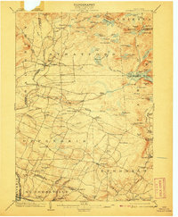
1903 Map of Lassellsville
USGS Topo · Published 1908About this map
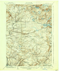
Stratford and Oppenheim anchor this 1901 survey, which illustrates the transition from industrial riverfronts to the wooded uplands of the southern Adirondacks. The southern edge of the sheet is dominated by the N. Y. C. and H. R. R. R. corridor through St. Johnsville, while the interior landscape is dotted with small-scale industrial hamlets such as Glasgow Mills and Newkirk Mills. The map reveals a dense network of family-named corners and crossroads, including Phipps Cors. and Fical Corners, alongside ethnic enclaves like the Irish Settlement. To the north, the terrain becomes increasingly defined by its water systems, from the Knapp Reservoir to the clusters of lakes near Arietta, reflecting the timber and mill economies that shaped Fulton and Herkimer Counties during the early twentieth century.
Find a feature on this map
106 named features on this map. Tap any name to fly to it.
Don’t see what you’re looking for? This feature index may not catch every label — zoom into the map to look around manually.
Map Details
Editions of this 1903 Lassellsville Map
6 editions found

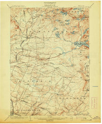
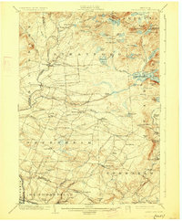
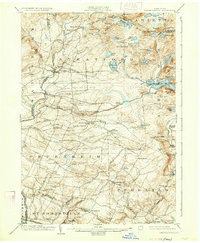
Other maps of this area

1896 · Fonda
USGS Topo · 1:62,500

1898 · Fonda
USGS Topo · 1:62,500

1898 · Canajoharie
USGS Topo · 1:62,500

1900 · Little Falls
USGS Topo · 1:62,500

1900 · Canajoharie
USGS Topo · 1:62,500

1900 · Wilmurt
USGS Topo · 1:62,500

1901 · Lassellsville
USGS Topo · 1:62,500

1902 · Canajoharie
USGS Topo · 1:62,500

1902 · Fonda
USGS Topo · 1:62,500

1902 · Wilmurt
USGS Topo · 1:62,500