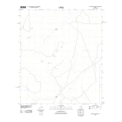
2010 Map of Last Chance Mesa
USGS Topo · Published 2010About this map
Last Chance Mesa anchors this landscape in Jeff Davis County, defined by a network of drainage systems and isolated water catchments essential for ranching in the high desert. The topographical relief is dominated by the steep incisions of Hatch Canyon to the north and the expansive Musquiz Canyon to the south. Water management is the primary human footprint visible on the terrain, represented by several named catchments including Duck Tank, Amistad Tank, and Herradura Tank. These features, along with the Musquiz Creek and Alpine Creek drainages, trace the natural flow of the land toward the southern basins. The sparse road network suggests a region primarily dedicated to large-scale livestock operations, where named landmarks like Big Rock Tank and Number Ten Tank serve as critical navigational points across the arid flats.
Find a feature on this map
11 named features on this map. Tap any name to fly to it.
Don’t see what you’re looking for? This feature index may not catch every label — zoom into the map to look around manually.
Map Details
Editions of this 2010 Last Chance Mesa Map
This is the sole edition of this map. No revisions or reprints were ever made.
Other maps of this area

1894 · Fort Davis
USGS Topo · 1:125,000

1895 · Alpine
USGS Topo · 1:125,000

1897 · Fort Davis
USGS Topo · 1:125,000

1923 · Altuda
USGS Topo · 1:62,500

1929 · Hovey
USGS Topo · 1:125,000

1954 · Fort Stockton
USGS Topo · 1:250,000

1958 · Fort Stockton
USGS Topo · 1:250,000

1972 · Alpine North
USGS Topo · 1:24,000

1972 · Elam Mountain
USGS Topo · 1:24,000

1973 · Fort Stockton
USGS Topo · 1:250,000