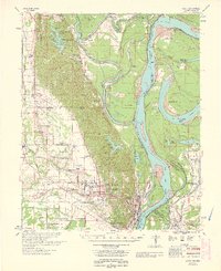
1963 Map of Latour
USGS Topo · Published 1963About this map
The St Francis River and Mississippi River dominate this landscape during the early 1960s, creating a complex network of oxbows and bends along the Arkansas Mississippi State Line. The urban centers of West Helena and Helena appear in high detail, showing the industrial and residential footprint near Helena Crossing. Between the rivers, the topography is defined by significant landmarks like Storm Creek Lake and the various "bars" and "points" that shift with the water's flow, such as Ground Lump Bar and Bordeaux Point.
Find a feature on this map
84 named features on this map. Tap any name to fly to it.
Don’t see what you’re looking for? This feature index may not catch every label — zoom into the map to look around manually.
Map Details
Editions of this 1963 Latour Map
This is the sole edition of this map. No revisions or reprints were ever made.
Other maps of this area

1908 · Lula
USGS Topo · 1:24,000

1908 · Dundee
USGS Topo · 1:24,000

1908 · Moon Lake
USGS Topo · 1:24,000

1910 · Dundee
USGS Topo · 1:31,680

1912 · Moon Lake
USGS Topo · 1:31,680

1912 · Lula
USGS Topo · 1:31,680

1931 · Horseshoe Lake
USGS Topo · 1:62,500

1932 · Marks
USGS Topo · 1:48,000

1935 · Marks
USGS Topo · 1:62,500

1939 · Clayton
USGS Topo · 1:62,500