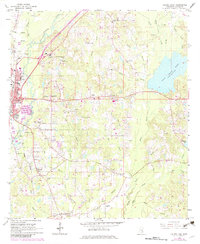
1964 Map of Laurel East
USGS Topo · Published 1982About this map
The eastern edges of Laurel meet the winding wetlands of the Big Tallahala Creek in this mid-century portrait of Jones County. The landscape is a complex mix of industrial infrastructure and rural community life, where the Southern and Illinois Central Gulf railroads anchor the local economy. On the outskirts, small settlements like Eastview and Glade are defined by their proximity to family-named landmarks and local institutions, including the Nora Davis Sch and numerous country churches like Smith Chapel and Antioch Ch.
Find a feature on this map
74 named features on this map. Tap any name to fly to it.
Don’t see what you’re looking for? This feature index may not catch every label — zoom into the map to look around manually.
Map Details
Editions of this 1964 Laurel East Map
4 editions found
Other maps of this area

1953 · Hattiesburg
USGS Topo · 1:250,000

1958 · Hattiesburg
USGS Topo · 1:250,000

1964 · Heidelberg SW
USGS Topo · 1:24,000

1964 · Moss
USGS Topo · 1:24,000

1964 · Sandersville
USGS Topo · 1:24,000

1964 · Laurel East
USGS Topo · 1:24,000

1964 · Laurel West
USGS Topo · 1:24,000

1964 · Ellisville
USGS Topo · 1:24,000

1964 · Myrick
USGS Topo · 1:24,000

1964 · Strengthford
USGS Topo · 1:24,000