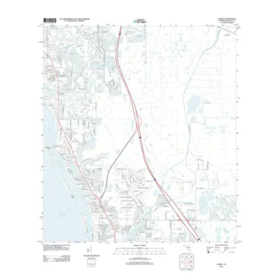
2012 Map of Laurel
USGS Topo · Published 2012About this map
Little Sarasota Bay and the barrier island of Casey Key define the coastal character of this Sarasota County landscape. The map captures the dense residential network of the early 21st century, with extensive canal developments and neighborhood streets branching from Vamo Rd and McIntosh Rd. This era shows significant land preservation and public space, most notably the expansive Oscar Scherer State Park and the recently established Sarasota National Cem in the northeast. Water remains the primary geographical feature, as tidal inlets like Dryman Bay and Blackburn Bay meet the inland drainage of Cow Pen Slough and Catfish Creek. The map documents the interface of Florida's suburban expansion with its sensitive coastal wetlands at Blackburn Point.
Find a feature on this map
176 named features on this map. Tap any name to fly to it.
Don’t see what you’re looking for? This feature index may not catch every label — zoom into the map to look around manually.
Map Details
Editions of this 2012 Laurel Map
This is the sole edition of this map. No revisions or reprints were ever made.
Other maps of this area

1943 · Laurel
USGS Topo · 1:24,000

1944 · Bird Keys
USGS Topo · 1:31,680

1944 · Sarasota
USGS Topo · 1:31,680

1944 · Lower Myakka Lake
USGS Topo · 1:31,680

1944 · Myakka River
USGS Topo · 1:31,680

1944 · Laurel
USGS Topo · 1:31,680

1944 · Venice
USGS Topo · 1:31,680

1944 · Miakka
USGS Topo · 1:31,680

1947 · Bee Ridge
USGS Topo · 1:24,000

1956 · Tampa
USGS Topo · 1:250,000