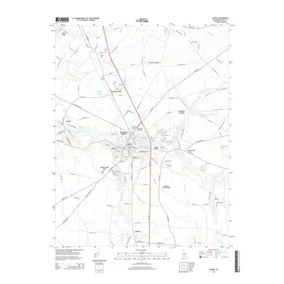
2014 Map of Laurel
USGS Topo · Published 2014About this map
Broad Creek and Laurel Creek converge in this corner of the Delmarva Peninsula, defining the layout of the town of Laurel. The landscape is a intricate network of waterways and ponds, including Records Pond and Horseys Pond, which have long influenced the development of surrounding communities like Bethel and Bacons. This modern survey reveals a dense concentration of local heritage sites, particularly cemeteries such as Laurel Hill Cem, Odd Fellows Cem, and the New Mt Zion Methodist Cem.
Find a feature on this map
158 named features on this map. Tap any name to fly to it.
Don’t see what you’re looking for? This feature index may not catch every label — zoom into the map to look around manually.
Map Details
Editions of this 2014 Laurel Map
This is the sole edition of this map. No revisions or reprints were ever made.
Other maps of this area

1901 · Salisbury
USGS Topo · 1:62,500

1902 · Pittsville
USGS Topo · 1:62,500

1915 · Seaford
USGS Topo · 1:62,500

1917 · Millsboro
USGS Topo · 1:62,500

1938 · Millsboro
USGS Topo · 1:62,500

1942 · Hebron
USGS Topo · 1:24,000

1942 · Delmar
USGS Topo · 1:24,000

1942 · Pittsville
USGS Topo · 1:24,000
1943 · Delmar
USGS Topo · 1:31,680

1943 · Hebron
USGS Topo · 1:31,680