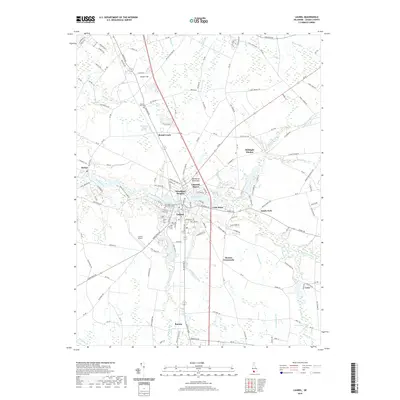
2019 Map of Laurel
USGS Topo · Published 2019About this map
The town of Laurel sits at the heart of this Sussex County landscape, where the waters of Broad Creek meet Records Pond. This 2019 survey captures the developed corridor along the Delmarva Peninsula, showing the expansion of residential communities like Lakeside Manor, Woodland Heights, and Lake Pines. The map is particularly valuable for genealogical research, documenting several significant burial grounds including the New Mount Zion Methodist Cem, Odd Fellows Cem, and Laurel Hill Cem.
Find a feature on this map
159 named features on this map. Tap any name to fly to it.
Don’t see what you’re looking for? This feature index may not catch every label — zoom into the map to look around manually.
Map Details
Editions of this 2019 Laurel Map
This is the sole edition of this map. No revisions or reprints were ever made.
Other maps of this area

1901 · Salisbury
USGS Topo · 1:62,500

1902 · Pittsville
USGS Topo · 1:62,500

1915 · Seaford
USGS Topo · 1:62,500

1917 · Millsboro
USGS Topo · 1:62,500

1938 · Millsboro
USGS Topo · 1:62,500

1942 · Hebron
USGS Topo · 1:24,000

1942 · Delmar
USGS Topo · 1:24,000

1942 · Pittsville
USGS Topo · 1:24,000
1943 · Delmar
USGS Topo · 1:31,680

1943 · Hebron
USGS Topo · 1:31,680