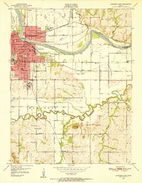
1950 Map of Lawrence East
USGS Topo · Published 1952About this map
The University of Kansas and the historic campus of the Haskell Institute anchor the eastern edges of a growing university town in the mid-twentieth century. This survey documents the urban footprint of Lawrence as it extends toward the Kansas River and Wakarusa River bottoms. The map reveals a landscape defined by institutional hubs and educational centers, including the Jr High Sch, New York Sch, and India Sch.
Find a feature on this map
54 named features on this map. Tap any name to fly to it.
Don’t see what you’re looking for? This feature index may not catch every label — zoom into the map to look around manually.
Map Details
Editions of this 1950 Lawrence East Map
4 editions found
Other maps of this area

1885 · Lawrence
USGS Topo · 1:125,000

1886 · Oskaloosa
USGS Topo · 1:125,000

1888 · Oskaloosa
USGS Topo · 1:125,000

1889 · Lawrence
USGS Topo · 1:125,000

1894 · Oskaloosa
USGS Topo · 1:125,000

1947 · Lawrence
USGS Topo · 1:250,000

1949 · Williamstown
USGS Topo · 1:24,000

1950 · Kansas City
USGS Topo · 1:250,000

1950 · Williamstown
USGS Topo · 1:24,000

1950 · Lawrence
USGS Topo · 1:250,000