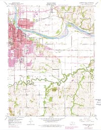
1950 Map of Lawrence East
USGS Topo · Published 1978About this map
Lawrence serves as the hub of this mid-century survey, positioned at the confluence of the Kansas River and a dense network of major railroads. The city's academic and social infrastructure is well-defined, showing the sprawling University of Kansas campus and the historic Haskell Institute alongside local landmarks like the Court House, City Hall, and several neighborhood schools including Lincoln Sch and Cordley Sch. To the north, Bismarck Grove sits near the Union Pacific line, while the southern landscape is dominated by the winding path of the Wakarusa River and the prominent elevation of Blue Mound. The river valleys show a mix of industrial progress and rural persistence, with the Kansas Toll Road Turnpike cutting across the northern reaches while small communities like Sibleyville and Noria maintain their footing in the outlying river plains.
Find a feature on this map
41 named features on this map. Tap any name to fly to it.
Don’t see what you’re looking for? This feature index may not catch every label — zoom into the map to look around manually.
Map Details
Editions of this 1950 Lawrence East Map
4 editions found
Other maps of this area

1885 · Lawrence
USGS Topo · 1:125,000

1886 · Oskaloosa
USGS Topo · 1:125,000

1888 · Oskaloosa
USGS Topo · 1:125,000

1889 · Lawrence
USGS Topo · 1:125,000

1894 · Oskaloosa
USGS Topo · 1:125,000

1947 · Lawrence
USGS Topo · 1:250,000

1949 · Williamstown
USGS Topo · 1:24,000

1950 · Kansas City
USGS Topo · 1:250,000

1950 · Williamstown
USGS Topo · 1:24,000

1950 · Lawrence
USGS Topo · 1:250,000