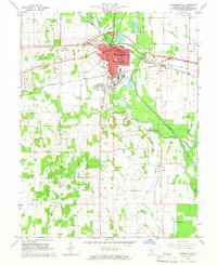
1965 Map of Lawrenceville
USGS Topo · Published 1966About this map
Lawrenceville serves as the focal point of this mid-1960s study, showcasing a landscape defined by the intersection of industrial development and rural tradition. The presence of a massive Refinery on the southeastern edge of the city highlights the area's economic importance during this era, while the surrounding territory remains dotted with family-named landmarks and rural institutions. To the west, the community of Bridgeport and the crossroad of Grays Corner anchor the western reaches, while the Old Embarras River Channel meanders through the central terrain, influencing the placement of settlements and roads.
Find a feature on this map
38 named features on this map. Tap any name to fly to it.
Don’t see what you’re looking for? This feature index may not catch every label — zoom into the map to look around manually.
Map Details
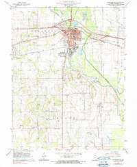
Editions of this 1965 Lawrenceville Map
2 editions found
Other maps of this area

1910 · Hardinville
USGS Topo · 1:62,500

1911 · Sumner
USGS Topo · 1:62,500

1913 · Sumner
USGS Topo · 1:62,500

1915 · Vincennes
USGS Topo · 1:62,500

1917 · Birds
USGS Topo · 1:62,500

1942 · Birds
USGS Topo · 1:62,500

1944 · Vincennes
USGS Topo · 1:62,500

1956 · Vincennes
USGS Topo · 1:250,000

1957 · Vincennes
USGS Topo · 1:250,000

1958 · Vincennes
USGS Topo · 1:250,000