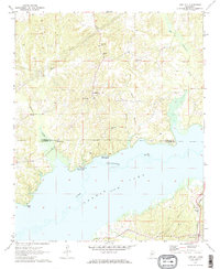
1971 Map of Laws Hill
USGS Topo · Published 1973About this map
Little Sardis Lake dominates the southern half of this 1971 survey, where the waters of the Tallahatchie River back up across the Marshall and Lafayette county line. The settlement of Abbeville sits at the southeastern corner, serving as a hub for the Illinois Central railroad and a cluster of local landmarks including the Abbeville Cem, Mt Vernon Ch, and Bible Way Ch.
Find a feature on this map
30 named features on this map. Tap any name to fly to it.
Don’t see what you’re looking for? This feature index may not catch every label — zoom into the map to look around manually.
Map Details
Editions of this 1971 Laws Hill Map
2 editions found

Other maps of this area

1940 · Oxford
USGS Topo · 1:62,500

1942 · Denmark
USGS Topo · 1:62,500

1943 · Denmark
USGS Topo · 1:62,500

1943 · Oxford
USGS Topo · 1:62,500

1944 · Tyro
USGS Topo · 1:62,500

1944 · Potts Camp
USGS Topo · 1:62,500

1945 · Potts Camp
USGS Topo · 1:62,500

1956 · Tupelo
USGS Topo · 1:250,000

1958 · Tupelo
USGS Topo · 1:250,000

1964 · Waterford
USGS Topo · 1:24,000