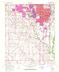
1956 Map of Lawton
USGS Topo · Published 1971About this map
Lawton's mid-century expansion is documented here, showing a city defined by its proximity to military grounds and a growing transportation network. The northern edge of the map is dominated by the Fort Sill Indian Reservation, while the city's civic core features the Carnegie Library, County Courthouse, and Memorial Hospital. Educational institutions are densely packed throughout the urban grid, from Scott School in the north to the Bishop School further south.
Find a feature on this map
53 named features on this map. Tap any name to fly to it.
Don’t see what you’re looking for? This feature index may not catch every label — zoom into the map to look around manually.
Map Details
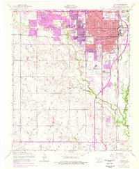
Editions of this 1956 Lawton Map
3 editions found

Other maps of this area

1937 · Cache
USGS Topo · 1:48,000

1942 · Cache
USGS Topo · 1:62,500

1946 · Lawton
USGS Topo · 1:62,500

1949 · Mount Scott
USGS Topo · 1:24,000

1949 · Arbuckle Hill
USGS Topo · 1:24,000

1949 · Fort Sill
USGS Topo · 1:24,000

1955 · Lawton
USGS Topo · 1:250,000

1956 · Ninemile Creek
USGS Topo · 1:24,000

1956 · Arbuckle Hill
USGS Topo · 1:24,000
1956 · Mount Scott
USGS Topo · 1:24,000