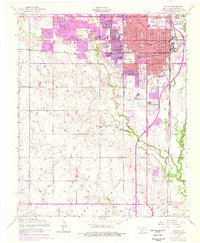
1956 Map of Lawton
USGS Topo · Published 1976About this map
The Cameron State Agriculture College campus and the historic downtown of Lawton are central to this mid-century survey of Comanche County. The map details a period of significant urban growth, with residential developments expanding toward West Branch Wolf Creek and the southern City Boundary. The urban infrastructure is robust, featuring institutions like Memorial Hospital, the McMahon Memorial Bldg, and numerous neighborhood schools such as Edison Sch and Washington School.
Find a feature on this map
63 named features on this map. Tap any name to fly to it.
Don’t see what you’re looking for? This feature index may not catch every label — zoom into the map to look around manually.
Map Details
Editions of this 1956 Lawton Map
3 editions found

Other maps of this area

1937 · Cache
USGS Topo · 1:48,000

1942 · Cache
USGS Topo · 1:62,500

1946 · Lawton
USGS Topo · 1:62,500

1949 · Mount Scott
USGS Topo · 1:24,000

1949 · Arbuckle Hill
USGS Topo · 1:24,000

1949 · Fort Sill
USGS Topo · 1:24,000

1955 · Lawton
USGS Topo · 1:250,000

1956 · Ninemile Creek
USGS Topo · 1:24,000

1956 · Arbuckle Hill
USGS Topo · 1:24,000
1956 · Mount Scott
USGS Topo · 1:24,000