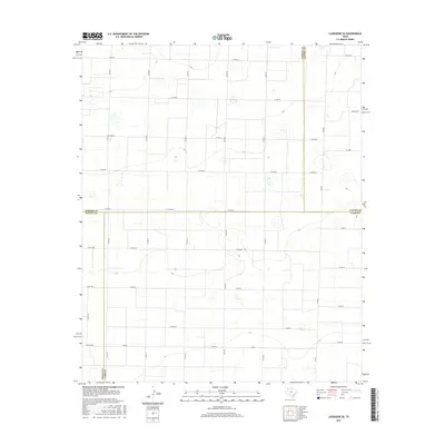
2016 Map of Lazbuddie SE
USGS Topo · Published 2016About this map
The High Plains of the Texas Panhandle meet at a unique four-county junction on this landscape, where Parmer, Castro, Bailey, and Lamb counties converge. The terrain is defined by a rigorous grid of section roads that overlay the subtle topography of the Llano Estacado. This 2016 survey illustrates the persistent agricultural geometry of the region, anchored by the north-south corridors of Fm 303 and Fm 2910. Dozens of numbered county roads, such as Co Rd Ee and Co RD 60, crisscross the territory, serving the isolated farmsteads and rural properties that characterize this part of West Texas. Small, scattered depressions in the landscape represent the natural drainage and playa features typical of this semi-arid plateau, which remain central to the area's hydrology and land-use patterns.
Find a feature on this map
37 named features on this map. Tap any name to fly to it.
Don’t see what you’re looking for? This feature index may not catch every label — zoom into the map to look around manually.
Map Details
Editions of this 2016 Lazbuddie SE Map
This is the sole edition of this map. No revisions or reprints were ever made.
Other maps of this area

1954 · Clovis
USGS Topo · 1:250,000

1958 · Clovis
USGS Topo · 1:250,000

1962 · Muleshoe
USGS Topo · 1:24,000

1962 · Muleshoe NE
USGS Topo · 1:24,000

1963 · Flagg
USGS Topo · 1:24,000

1963 · Clays Corner
USGS Topo · 1:24,000

1963 · Earth
USGS Topo · 1:24,000

1963 · Lazbuddie
USGS Topo · 1:24,000

1963 · Dodd
USGS Topo · 1:24,000

1963 · Lazbuddie SW
USGS Topo · 1:24,000