
1951 Map of Leader
USGS Topo · Published 1953About this map
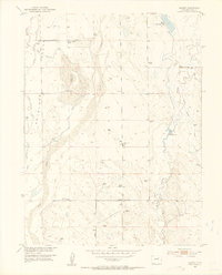
Bijou Creek and its many intermittent tributaries define the rolling landscape of eastern Adams County, where small-scale irrigation and cattle ranching shaped the early 20th-century economy. The area around Leader was part of a mid-century effort to develop the Missouri River Basin, evident here in the complex system of water management features. While the Nile Reservoir (Abandoned) suggests a shift in local water usage, the presence of the Nile Ditch and several active impoundments like Moore Reservoir No 4 highlight the ongoing importance of water rights in these Antelope Flats. A network of rural institutions, including the Pleasant Valley School, Moore School, and Leader School, along with the Leader Community Hall, points to a tight-knit prairie community during this era. An Airway Beacon serves as a modern landmark in this high-plains terrain.
Find a feature on this map
21 named features on this map. Tap any name to fly to it.
Don’t see what you’re looking for? This feature index may not catch every label — zoom into the map to look around manually.
Map Details
Editions of this 1951 Leader Map
5 editions found
Other maps of this area

1950 · Wiggins SW
USGS Topo · 1:24,000

1950 · Hoyt
USGS Topo · 1:24,000

1951 · Hoyt
USGS Topo · 1:24,000

1951 · Leader NW
USGS Topo · 1:24,000

1951 · Leader SE
USGS Topo · 1:24,000

1952 · Leader SW
USGS Topo · 1:24,000

1953 · Denver
USGS Topo · 1:250,000

1954 · Limon
USGS Topo · 1:250,000

1954 · Sterling
USGS Topo · 1:250,000

1954 · Greeley
USGS Topo · 1:250,000