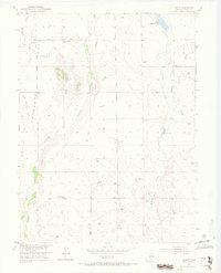
1951 Map of Leader
USGS Topo · Published 1972About this map
Antelope Flats defines the high plains landscape of eastern Adams County in this mid-century topographic study. The area is characterized by an extensive network of ephemeral drainages and water management features, including Bijou Creek, Muddy Creek, and several agricultural reservoirs. The presence of the Nile Reservoir (Abandoned) and the Nile Ditch illustrates the early 20th-century efforts to irrigate this semi-arid terrain.
Find a feature on this map
18 named features on this map. Tap any name to fly to it.
Don’t see what you’re looking for? This feature index may not catch every label — zoom into the map to look around manually.
Map Details
Editions of this 1951 Leader Map
5 editions found
Other maps of this area

1950 · Wiggins SW
USGS Topo · 1:24,000

1950 · Hoyt
USGS Topo · 1:24,000

1951 · Hoyt
USGS Topo · 1:24,000

1951 · Leader NW
USGS Topo · 1:24,000

1951 · Leader SE
USGS Topo · 1:24,000

1951 · Leader
USGS Topo · 1:24,000

1952 · Leader SW
USGS Topo · 1:24,000

1953 · Denver
USGS Topo · 1:250,000

1954 · Limon
USGS Topo · 1:250,000

1954 · Sterling
USGS Topo · 1:250,000