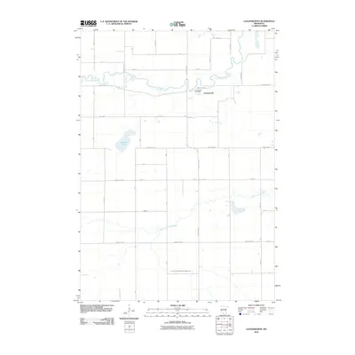
2010 Map of Leavenworth
USGS Topo · Published 2010About this map
Leavenworth is the focal point of this rural Brown County landscape, where the Leavenworth Post Office serves the local agricultural community. The settlement is positioned south of a sharp bend in the Cottonwood River, which snakes across the northern portion of the quadrangle. Further south, the Little Cottonwood River and the County Ditch Number Twenty-eight-one define the drainage patterns of the prairie, illustrating the extensive water management systems essential to Minnesota's farming heritage. The terrain is dotted with small water bodies, most notably Altermatt Lake in the western section. A rigid grid of township roads and county highways, such as County Hwy-24 and 340th Ave, organizes the land into a highly structured quilt of fields, reflecting a century of land use in the Upper Midwest.
Find a feature on this map
37 named features on this map. Tap any name to fly to it.
Don’t see what you’re looking for? This feature index may not catch every label — zoom into the map to look around manually.
Map Details
Editions of this 2010 Leavenworth Map
This is the sole edition of this map. No revisions or reprints were ever made.
Other maps of this area

1953 · Morgan
USGS Topo · 1:62,500

1953 · New Ulm
USGS Topo · 1:250,000

1957 · New Ulm
USGS Topo · 1:250,000

1958 · New Ulm
USGS Topo · 1:250,000

1964 · Sleepy Eye
USGS Topo · 1:24,000

1967 · New Ulm
USGS Topo · 1:250,000

1967 · Lake Hanska West
USGS Topo · 1:24,000

1967 · Springfield
USGS Topo · 1:24,000

1967 · Godahl
USGS Topo · 1:24,000

1967 · Darfur
USGS Topo · 1:24,000