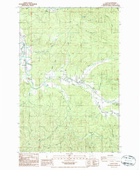
1986 Map of Lebam
USGS Topo · Published 1986About this map
The Willapa Valley serves as the central artery of this Pacific County landscape, where the Willapa River winds through a series of small riverside settlements. Along its course, established communities like Lebam, Holcomb, and Frances are connected by a road network that often mirrors the path of the river and the Old Railroad Grade to the north. This mid-1980s data illustrates a rural economy tied to the land and water, evidenced by the Fish Hatchery near Nallpee and various resource extraction points such as the Gravel Pit near Globe.
Find a feature on this map
36 named features on this map. Tap any name to fly to it.
Don’t see what you’re looking for? This feature index may not catch every label — zoom into the map to look around manually.
Map Details
Editions of this 1986 Lebam Map
2 editions found
Other maps of this area

1940 · Brookfield
USGS Topo · 1:62,500

1941 · Walville
USGS Topo · 1:62,500

1941 · Skamokawa
USGS Topo · 1:62,500

1949 · Upper Naselle River
USGS Topo · 1:24,000

1953 · Hoquiam
USGS Topo · 1:250,000

1953 · Skamokawa
USGS Topo · 1:62,500

1953 · Pe Ell
USGS Topo · 1:62,500

1955 · Grays River
USGS Topo · 1:62,500

1955 · Raymond
USGS Topo · 1:62,500

1957 · Hoquiam
USGS Topo · 1:250,000