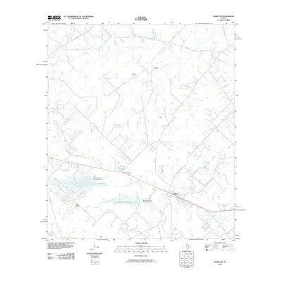
2010 Map of Ledbetter
USGS Topo · Published 2010About this map
Ledbetter serves as the primary hub of this rural Fayette County landscape, where the road network converges near the banks of Cummins Creek. The terrain is defined by an intricate system of water management, including the Soil Conservation Service Site 1 Reservoir and Soil Conservation Service Site 2 Reservoir, along with Goerlitz Lake and its associated dam. These features highlight the mid-century and later efforts to control local hydrology for agricultural and conservation purposes. Genealogists will find significant local value in the presence of family-named burial grounds such as Atkinson Cemetery, Rost Cemetery, and Wolf Cemetery, which are scattered throughout the countryside. The map also documents the Bar S Ranch Airport, reflecting the integration of private aviation into the ranching economy. Numerous small waterways, such as Nails Creek, Pin Oak Creek, and Flat Rock Creek, weave through the parcels of land, providing a clear picture of the area's natural drainage and property boundaries.
Find a feature on this map
52 named features on this map. Tap any name to fly to it.
Don’t see what you’re looking for? This feature index may not catch every label — zoom into the map to look around manually.
Map Details
Editions of this 2010 Ledbetter Map
This is the sole edition of this map. No revisions or reprints were ever made.
Other maps of this area

1919 · Giddings
USGS Topo · 1:62,500

1919 · Dime Box
USGS Topo · 1:62,500

1954 · Austin
USGS Topo · 1:250,000

1956 · Somerville
USGS Topo · 1:62,500

1958 · Ledbetter
USGS Topo · 1:24,000
1958 · Nechanitz
USGS Topo · 1:24,000

1958 · Carmine
USGS Topo · 1:24,000
1958 · Round Top
USGS Topo · 1:24,000
1958 · Giddings
USGS Topo · 1:24,000

1959 · Flag Pond
USGS Topo · 1:24,000