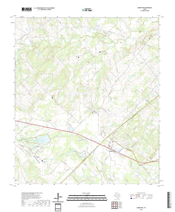
2022 Map of Ledbetter
USGS Topo · Published 2022About this map
The town of Ledbetter sits at the intersection of local history and rural geography, where the boundaries of Lee, Washington, and Fayette counties meet. This landscape is defined by its complex drainage network, primarily fed by Cummins Creek and its various tributaries like W Fork Cummins Cr and Alexander Br. The map reveals a deeply established rural community, evidenced by numerous small family and community burial grounds scattered across the countryside, including Post Oak Sunny Side Cem, Globe Hill Cem, and Jones Colony Cem.
Find a feature on this map
90 named features on this map. Tap any name to fly to it.
Don’t see what you’re looking for? This feature index may not catch every label — zoom into the map to look around manually.
Map Details
Editions of this 2022 Ledbetter Map
This is the sole edition of this map. No revisions or reprints were ever made.
Other maps of this area

1919 · Giddings
USGS Topo · 1:62,500

1919 · Dime Box
USGS Topo · 1:62,500

1954 · Austin
USGS Topo · 1:250,000

1956 · Somerville
USGS Topo · 1:62,500

1958 · Ledbetter
USGS Topo · 1:24,000
1958 · Nechanitz
USGS Topo · 1:24,000

1958 · Carmine
USGS Topo · 1:24,000
1958 · Round Top
USGS Topo · 1:24,000
1958 · Giddings
USGS Topo · 1:24,000

1959 · Flag Pond
USGS Topo · 1:24,000