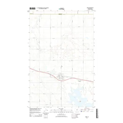
2014 Map of Leeds
USGS Topo · Published 2014About this map
Leeds serves as a central hub in this section of the northern plains, where the grid of agricultural section lines meets the diagonal path of Us-2. The town's layout is clearly defined by local thoroughfares like Main St E, Central Ave S, and 1st St SW, indicating a well-established community structure. Outside the town limits, the landscape is characterized by the presence of numerous seasonal basins and the larger Lake Ibsen to the south, which includes a distinct landform known as The Island. The Leeds Cem north of town and the Leeds Municipal Airport to the east highlight the essential civic and transportation infrastructure supporting this rural corridor. This survey captures the region where Towner Co and Benson Co meet, reflecting the enduring pattern of North Dakota's prairie settlement.
Find a feature on this map
32 named features on this map. Tap any name to fly to it.
Don’t see what you’re looking for? This feature index may not catch every label — zoom into the map to look around manually.
Map Details
Editions of this 2014 Leeds Map
This is the sole edition of this map. No revisions or reprints were ever made.
Other maps of this area

1953 · Devils Lake
USGS Topo · 1:250,000

1956 · Devils Lake
USGS Topo · 1:250,000

1956 · Brinsmade
USGS Topo · 1:24,000

1957 · Comstock
USGS Topo · 1:24,000
1957 · Brinsmade
USGS Topo · 1:24,000

1958 · Harlow
USGS Topo · 1:24,000

1971 · Leeds NE
USGS Topo · 1:24,000

1971 · Hurricane Lake West
USGS Topo · 1:24,000

1971 · York
USGS Topo · 1:24,000

1971 · Leeds
USGS Topo · 1:24,000