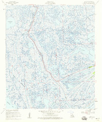
1957 Map of Leesville
USGS Topo · Published 1959About this map
Bayou Lafourche cuts a distinct path through the wetlands of Lafourche Parish, serving as the primary corridor for settlement and industry in this amphibious landscape. At the northern edge, the community of Leeville clings to the high ground along the bayou, marked by a local Cem, a substation, and several masts. The surrounding terrain is a complex network of marshes, open water, and human engineering, where the Southwestern Louisiana Canal intersects natural waterways like Bayou Moreau and Bayou Cochon.
Find a feature on this map
25 named features on this map. Tap any name to fly to it.
Don’t see what you’re looking for? This feature index may not catch every label — zoom into the map to look around manually.
Map Details
Editions of this 1957 Leesville Map
3 editions found
Other maps of this area

1941 · Leesville
USGS Topo · 1:62,500

1941 · Slagle
USGS Topo · 1:62,500

1942 · Florien
USGS Topo · 1:62,500

1942 · Kisatchie
USGS Topo · 1:62,500

1943 · Leesville
USGS Topo · 1:62,500

1943 · Kisatchie
USGS Topo · 1:62,500

1944 · Florien
USGS Topo · 1:62,500

1944 · Slagle
USGS Topo · 1:62,500

1946 · Leesville
USGS Topo · 1:62,500

1948 · Leesville
USGS Topo · 1:62,500