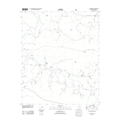
2012 Map of Leflore SE
USGS Topo · Published 2012About this map
Reichert sits at the northeastern corner of this landscape, serving as a primary point of reference in a region defined by complex drainage basins and prominent ridges. The topography is dominated by several significant elevations, including Coleman Ridge, Brushy Mtn, and Clebit Ridge, which channel numerous tributaries toward the Holson Cr system. The area's hydrology is particularly intricate, with named waterways like Upper Holson Cr, Wildhorse Cr, and Negro Br winding through deeply carved terrain features such as Sulphur Spring Hollow and Clearwater Hollow.
Find a feature on this map
40 named features on this map. Tap any name to fly to it.
Don’t see what you’re looking for? This feature index may not catch every label — zoom into the map to look around manually.
Map Details
Editions of this 2012 Leflore SE Map
This is the sole edition of this map. No revisions or reprints were ever made.
Other maps of this area

1900 · Winding Stair
USGS Topo · 1:125,000

1909 · Winding Stair
USGS Topo · 1:125,000

1950 · Mcalester
USGS Topo · 1:250,000

1959 · Page
USGS Topo · 1:62,500

1959 · Heavener
USGS Topo · 1:62,500

1962 · McAlester
USGS Topo · 1:250,000

1965 · McAlester
USGS Topo · 1:250,000
1965 · Leflore
USGS Topo · 1:24,000
1965 · Summerfield
USGS Topo · 1:24,000
1966 · Muse
USGS Topo · 1:24,000