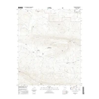
2016 Map of Leflore SE
USGS Topo · Published 2016About this map
The community of Reichert sits at the northern edge of this high-elevation landscape, where the flat valley lands begin to rise sharply into the ridges of the Ouachita National Forest. The map is dominated by the massive east-west spine of Winding Stair Mtn and Blue Mtn, separated by numerous deep drainages including Sulphur Spring Hollow and Stark Hollow. This area reflects the transition from agricultural valley life to the rugged timberlands of the interior mountains.
Find a feature on this map
43 named features on this map. Tap any name to fly to it.
Don’t see what you’re looking for? This feature index may not catch every label — zoom into the map to look around manually.
Map Details
Editions of this 2016 Leflore SE Map
This is the sole edition of this map. No revisions or reprints were ever made.
Other maps of this area

1900 · Winding Stair
USGS Topo · 1:125,000

1909 · Winding Stair
USGS Topo · 1:125,000

1950 · Mcalester
USGS Topo · 1:250,000

1959 · Page
USGS Topo · 1:62,500

1959 · Heavener
USGS Topo · 1:62,500

1962 · McAlester
USGS Topo · 1:250,000

1965 · McAlester
USGS Topo · 1:250,000
1965 · Leflore
USGS Topo · 1:24,000
1965 · Summerfield
USGS Topo · 1:24,000
1966 · Muse
USGS Topo · 1:24,000