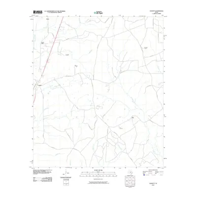
2010 Map of Leggett
USGS Topo · Published 2010About this map
Seven Oaks and Leggett anchor this portion of Polk County, where the landscape is defined by the winding drainages of the Big Sandy Creek and Menard Creek systems. At the time of this 2010 survey, the area maintained a rural character with scattered settlements like Ollie and Walda connected by a network of local routes including FM 942 and Old Hwy 35 N. This map is particularly valuable for genealogical research, as it clearly identifies family and community landmarks such as Carrington Cemetery, Oaks Cemetery, and Rice Cemetery.
Find a feature on this map
49 named features on this map. Tap any name to fly to it.
Don’t see what you’re looking for? This feature index may not catch every label — zoom into the map to look around manually.
Map Details
Editions of this 2010 Leggett Map
This is the sole edition of this map. No revisions or reprints were ever made.
Other maps of this area

1954 · Beaumont
USGS Topo · 1:250,000

1955 · Camden
USGS Topo · 1:62,500

1955 · New Willard
USGS Topo · 1:62,500

1957 · Beaumont
USGS Topo · 1:250,000

1958 · Livingston
USGS Topo · 1:62,500

1958 · Segno
USGS Topo · 1:62,500

1984 · Hortense
USGS Topo · 1:24,000

1984 · Soda
USGS Topo · 1:24,000

1984 · Beaumont
USGS Topo · 1:250,000
1984 · Livingston
USGS Topo · 1:24,000