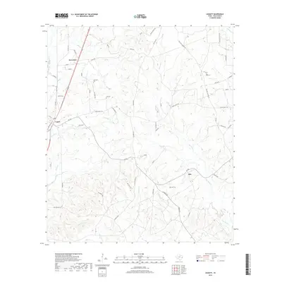
2019 Map of Leggett
USGS Topo · Published 2019About this map
Seven Oaks and Leggett anchor this part of Polk County, where the Piney Woods landscape is defined by an intricate network of creeks and family burial grounds. The terrain is deeply etched by waterways like Big Sandy Creek and Alexander Creek, which flow through a topography mapped in fine detail. For those tracing local heritage, the map identifies several vital landmarks including Carrington Cemetery, Oats Cemetery, and Pine Ridge Cemetery, reflecting the area's established rural community. A complex grid of local roads, such as Pine Ridge Cemetery Road and Red Hollow, connects scattered settlements and farmsteads. The southern reaches are marked by the presence of Ollie and several smaller tributaries like Menard Creek, illustrating the transition from open woods to more defined agricultural or residential plots near the edge of the quadrangle.
Find a feature on this map
62 named features on this map. Tap any name to fly to it.
Don’t see what you’re looking for? This feature index may not catch every label — zoom into the map to look around manually.
Map Details
Editions of this 2019 Leggett Map
This is the sole edition of this map. No revisions or reprints were ever made.
Other maps of this area

1954 · Beaumont
USGS Topo · 1:250,000

1955 · Camden
USGS Topo · 1:62,500

1955 · New Willard
USGS Topo · 1:62,500

1957 · Beaumont
USGS Topo · 1:250,000

1958 · Livingston
USGS Topo · 1:62,500

1958 · Segno
USGS Topo · 1:62,500

1984 · Hortense
USGS Topo · 1:24,000

1984 · Soda
USGS Topo · 1:24,000

1984 · Beaumont
USGS Topo · 1:250,000
1984 · Livingston
USGS Topo · 1:24,000