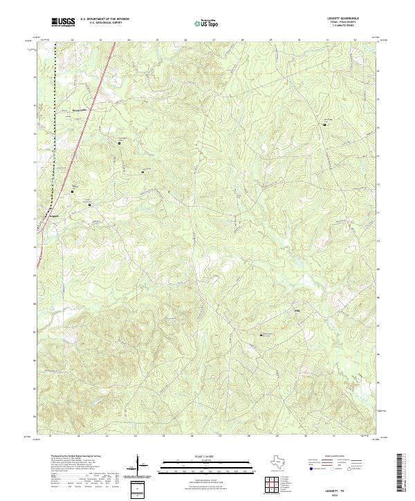
2022 Map of Leggett
USGS Topo · Published 2022About this map
The timberlands of Polk County are defined by a network of creeks and small family burial grounds. The settlement of Leggett serves as a local hub, situated near the western edge of this territory where the landscape transitions into a complex of drainage basins including Alexander Cr and Milton Cr. To the northeast, Seven Oaks anchors a corridor of named roads like Old Hwy 35 N, reflecting the area's rural transportation evolution.
Find a feature on this map
66 named features on this map. Tap any name to fly to it.
Don’t see what you’re looking for? This feature index may not catch every label — zoom into the map to look around manually.
Map Details
Editions of this 2022 Leggett Map
This is the sole edition of this map. No revisions or reprints were ever made.
Other maps of this area

1954 · Beaumont
USGS Topo · 1:250,000

1955 · Camden
USGS Topo · 1:62,500

1955 · New Willard
USGS Topo · 1:62,500

1957 · Beaumont
USGS Topo · 1:250,000

1958 · Livingston
USGS Topo · 1:62,500

1958 · Segno
USGS Topo · 1:62,500

1984 · Hortense
USGS Topo · 1:24,000

1984 · Soda
USGS Topo · 1:24,000

1984 · Beaumont
USGS Topo · 1:250,000
1984 · Livingston
USGS Topo · 1:24,000