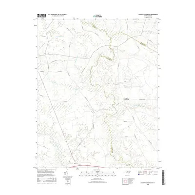
2016 Map of Leggetts Crossroads
USGS Topo · Published 2016About this map
Tranters Cr serves as a winding natural boundary between Martin, Pitt, and Beaufort Counties, defining a landscape dominated by extensive wetlands and drainage systems. This coastal plain topography is marked by numerous named swamps such as Briery Swamp, Turkey Swamp, and Horsepen Swamp, which dictate the placement of local thoroughfares. The settlement of Leggetts Crossroads sits at a junction of rural routes, while Stokes anchors the western portion of the area. Historically significant water features like Sheppard Millpond suggest earlier industrial or agricultural uses of the local hydrography. The map also reveals numerous family-named roads, including Huldy Taylor Rd and Jerome Butler Rd, which point to the deep-rooted local genealogy and land ownership patterns characteristic of these eastern North Carolina communities in the early 21st century.
Find a feature on this map
43 named features on this map. Tap any name to fly to it.
Don’t see what you’re looking for? This feature index may not catch every label — zoom into the map to look around manually.
Map Details
Editions of this 2016 Leggetts Crossroads Map
This is the sole edition of this map. No revisions or reprints were ever made.
Other maps of this area

1901 · Parmele
USGS Topo · 1:62,500

1901 · Williamston
USGS Topo · 1:62,500

1902 · Williamston
USGS Topo · 1:62,500

1902 · Parmele
USGS Topo · 1:62,500

1903 · Winterville
USGS Topo · 1:62,500

1903 · Chocowinity
USGS Topo · 1:62,500

1905 · Chocowinity
USGS Topo · 1:62,500

1905 · Winterville
USGS Topo · 1:62,500

1951 · Washington
USGS Topo · 1:24,000

1953 · Rocky Mount
USGS Topo · 1:250,000