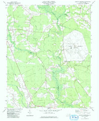
1979 Map of Leggetts Crossroads
USGS Topo · Published 1979About this map
The large Voice of America (Site A) facility dominates the landscape of eastern North Carolina in the late 1970s, characterized by its network of Radio Towers and cleared transmission fields. This map details a rural region where the borders of Pitt, Martin, and Beaufort counties converge amid a dense system of wetlands including Great Swamp and Bear Grass Swamp. The settlement at Pactolus sits in the southwest corner near the Seaboard Coast Line railroad, while Leggetts Crossroads serves as a central junction point for the surrounding farming community.
Find a feature on this map
30 named features on this map. Tap any name to fly to it.
Don’t see what you’re looking for? This feature index may not catch every label — zoom into the map to look around manually.
Map Details
Editions of this 1979 Leggetts Crossroads Map
This is the sole edition of this map. No revisions or reprints were ever made.
Other maps of this area

1901 · Parmele
USGS Topo · 1:62,500

1901 · Williamston
USGS Topo · 1:62,500

1902 · Williamston
USGS Topo · 1:62,500

1902 · Parmele
USGS Topo · 1:62,500

1903 · Winterville
USGS Topo · 1:62,500

1903 · Chocowinity
USGS Topo · 1:62,500

1905 · Chocowinity
USGS Topo · 1:62,500

1905 · Winterville
USGS Topo · 1:62,500

1951 · Washington
USGS Topo · 1:24,000

1953 · Rocky Mount
USGS Topo · 1:250,000