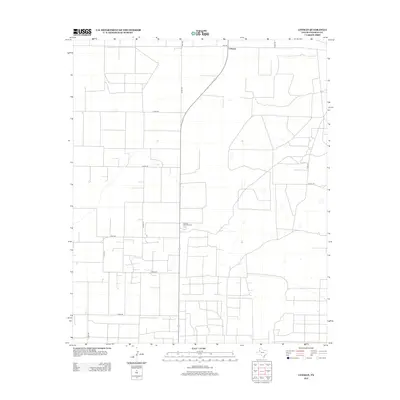
2012 Map of Lehman
USGS Topo · Published 2012About this map
Lehman is the central hub of this agricultural and industrial landscape in West Texas, situated at the junction of several farm-to-market roads. The town's economic character is defined by the presence of the Lehman Gasoline Plant, which sits south of the main settlement along Co Rd-117. This area of Cochran County shows a high-density grid of local transport, including Fm-769 and Fm-1779, which facilitates the movement of resources between the sprawling fields and processing facilities. The map illustrates how oil and gas infrastructure, like the gasoline plant, is integrated into the traditional ranching and farming landscape, creating a network of industrial sites connected by roads such as Co Rd-210 and Co Rd-160.
Find a feature on this map
14 named features on this map. Tap any name to fly to it.
Don’t see what you’re looking for? This feature index may not catch every label — zoom into the map to look around manually.
Map Details
Editions of this 2012 Lehman Map
This is the sole edition of this map. No revisions or reprints were ever made.
Other maps of this area

1954 · Brownfield
USGS Topo · 1:250,000

1958 · Brownfield
USGS Topo · 1:250,000

1962 · Brownfield
USGS Topo · 1:250,000

1969 · Lehman
USGS Topo · 1:24,000

1970 · Morton SW
USGS Topo · 1:24,000

1970 · Whiteface SW
USGS Topo · 1:24,000

1970 · Morton NW
USGS Topo · 1:24,000

1970 · Plains 1 NW
USGS Topo · 1:24,000

1971 · Whiteface NW
USGS Topo · 1:24,000

1971 · Schooler Ranch
USGS Topo · 1:24,000