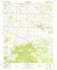
1971 Map of Leighton
USGS Topo · Published 1973About this map
La Grange Mountain rises sharply from the surrounding lowlands of Colbert County, Alabama, creating a distinct topographical boundary between the valley settlements and the high ground to the south. This 1971 revision by the Tennessee Valley Authority and USGS reveals a landscape shaped by the Southern railroad and agricultural heritage, centered on the community of Leighton. The map captures a high density of small family burial grounds and country churches, such as Mayers Cem and Galilee Ch, which reflect the localized social structure of the era. To the north, the encroachment of industrial infrastructure is evident at the Emco-Listerhill Junction, while the historic La Grange College Monument and Faith Tabernacle College Spring stand as markers of the area's mid-19th-century academic and religious roots. Unusual features like Sink Pond and Brush Pond point to the unique hydrology of the Tennessee Valley floor.
Find a feature on this map
56 named features on this map. Tap any name to fly to it.
Don’t see what you’re looking for? This feature index may not catch every label — zoom into the map to look around manually.
Map Details
Editions of this 1971 Leighton Map
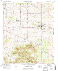
2 editions found
Other maps of this area

1914 · Rogersville
USGS Topo · 1:48,000

1914 · Muscle Shoals
USGS Topo · 1:48,000

1916 · Muscle Shoals
USGS Topo · 1:62,500

1916 · Rogersville
USGS Topo · 1:62,500

1924 · Tuscumbia
USGS Topo · 1:48,000

1926 · Tuscumbia
USGS Topo · 1:62,500

1936 · Russellville
USGS Topo · 1:24,000

1936 · Wheeler Dam
USGS Topo · 1:24,000

1936 · Florence
USGS Topo · 1:24,000

1936 · Town Creek
USGS Topo · 1:24,000