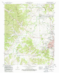
1981 Map of Leipers Fork
USGS Topo · Published 1988About this map
Backbone Ridge dominates the western topography of this 1980s landscape, while the Harpeth River carves intricate bends like Lumsden Bend to the north. This survey captures a rural Williamson County in transition, where legacy estates like Montpier Farms and Battlewood Estates sit alongside numerous family burial grounds. The mapping of multiple Slave Cem locations and an Indian Mound near Bradley Bend provides significant archaeological and genealogical data. Transport networks are deeply layered, showing the L&N Railroad and the Old Railroad Grade alongside historic thoroughfares such as the Old Charlotte Road and Del Rio Pike. In the south, the village of Leipers Fork serves as a local anchor near the West Fork Leipers Fork, illustrating a settlement pattern defined by the region's prominent hollows and creek valleys.
Find a feature on this map
110 named features on this map. Tap any name to fly to it.
Don’t see what you’re looking for? This feature index may not catch every label — zoom into the map to look around manually.
Map Details
Editions of this 1981 Leipers Fork Map
3 editions found
Other maps of this area

1901 · Colombia
USGS Topo · 1:125,000

1903 · Nashville
USGS Topo · 1:125,000

1909 · Franklin
USGS Topo · 1:62,500

1930 · White Bluff
USGS Topo · 1:62,500

1932 · Nashville
USGS Topo · 1:62,500

1933 · White Bluff
USGS Topo · 1:62,500

1936 · Spring Hill
USGS Topo · 1:24,000

1936 · Theta
USGS Topo · 1:24,000

1936 · Bethesda
USGS Topo · 1:24,000

1946 · Leipers Fork
USGS Topo · 1:24,000