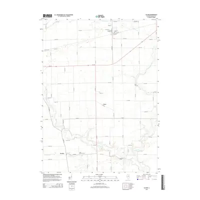
2015 Map of Leland
USGS Topo · Published 2015About this map
Leland occupies the northern edge of this LaSalle County landscape, where the local street grid including W Genessee St and E Railroad Ave intersects with a network of rural section roads. The area is defined by the winding course of Indian Creek and Little Indian Cr, which carve through the agricultural prairie towards the settlements of Baker and Harding. For genealogists, the map preserves the locations of several burial grounds, from the Saint Clara Catholic Cemetery near the northern border to the Pierce Family Cem and Baker Cem. Local aviation is represented by Humm Airport and Cody Port RLA Airport, reflecting the region's mid-century development of private landing strips alongside traditional farming. The drainage patterns of Crookedleg Cr illustrate the subtle topography of this Illinois heartland.
Find a feature on this map
55 named features on this map. Tap any name to fly to it.
Don’t see what you’re looking for? This feature index may not catch every label — zoom into the map to look around manually.
Map Details
Editions of this 2015 Leland Map
This is the sole edition of this map. No revisions or reprints were ever made.
Other maps of this area

1892 · Marseilles
USGS Topo · 1:62,500

1892 · Ottawa
USGS Topo · 1:62,500

1915 · Ottawa
USGS Topo · 1:62,500

1916 · Marseilles
USGS Topo · 1:62,500

1940 · Marseilles
USGS Topo · 1:62,500

1946 · Ottawa
USGS Topo · 1:62,500

1948 · Sandwich
USGS Topo · 1:62,500

1950 · Sandwich
USGS Topo · 1:62,500

1951 · Earlville
USGS Topo · 1:62,500

1958 · Aurora
USGS Topo · 1:250,000