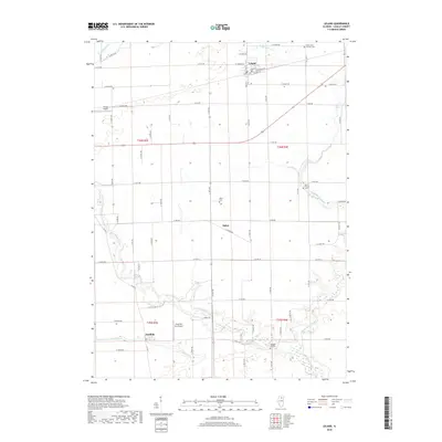
2018 Map of Leland
USGS Topo · Published 2018About this map
Leland stands as a focal point in this LaSalle County landscape, where the intersection of local history and modern infrastructure is clearly defined. The settlement is characterized by a grid of streets including W Genesee St and E Railroad Ave, illustrating its development alongside transportation corridors. The rural character of Adams Township is preserved through the naming of small communities like Baker and Harding, while several family and religious burial grounds such as the Saint Clara Catholic Cem and Pierce Family Cem offer significant touchpoints for genealogists. The terrain is shaped by the winding paths of Indian Creek and Little Indian Creek, which meander through the township sections. Local aviation is represented by Humm Airport and Cody Port RLA Airport, showing the continued utility of these open Illinois plains into the 21st century.
Find a feature on this map
42 named features on this map. Tap any name to fly to it.
Don’t see what you’re looking for? This feature index may not catch every label — zoom into the map to look around manually.
Map Details
Editions of this 2018 Leland Map
This is the sole edition of this map. No revisions or reprints were ever made.
Other maps of this area

1892 · Marseilles
USGS Topo · 1:62,500

1892 · Ottawa
USGS Topo · 1:62,500

1915 · Ottawa
USGS Topo · 1:62,500

1916 · Marseilles
USGS Topo · 1:62,500

1940 · Marseilles
USGS Topo · 1:62,500

1946 · Ottawa
USGS Topo · 1:62,500

1948 · Sandwich
USGS Topo · 1:62,500

1950 · Sandwich
USGS Topo · 1:62,500

1951 · Earlville
USGS Topo · 1:62,500

1958 · Aurora
USGS Topo · 1:250,000