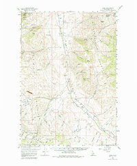
1956 Map of Lemhi
USGS Topo · Published 1964About this map
Sacajawea Monument and the Fort Lemhi Monument stand as notable historical markers within this rugged corridor of the Lemhi River valley. During the mid-1950s, the small settlements of Tendoy and Lemhi served as the primary hubs for a landscape defined by ranching and mountain transit. The valley floor is marked by essential infrastructure of the era, including a Gaging Sta and a Fish Hatchery, while the surrounding Beaverhead Mountains and Salmon National Forest are etched with drainage systems like Pattee Creek and Hayden Creek.
Find a feature on this map
58 named features on this map. Tap any name to fly to it.
Don’t see what you’re looking for? This feature index may not catch every label — zoom into the map to look around manually.
Map Details
Editions of this 1956 Lemhi Map
3 editions found
Other maps of this area

1950 · Salmon
USGS Topo · 1:62,500

1951 · Salmon
USGS Topo · 1:62,500

1955 · Dubois
USGS Topo · 1:250,000

1955 · Dillon
USGS Topo · 1:250,000

1956 · Leadore
USGS Topo · 1:62,500

1956 · Patterson
USGS Topo · 1:62,500

1956 · May
USGS Topo · 1:62,500

1956 · Goldstone Mtn
USGS Topo · 1:62,500

1956 · Lemhi
USGS Topo · 1:62,500

1957 · Dillon
USGS Topo · 1:250,000