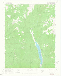
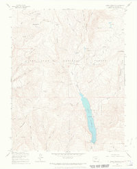
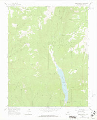
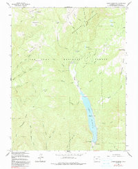
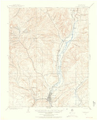
1964 Map of Lemon Reservoir
USGS Topo · Published 1968About this map
Lemon Reservoir dominates this high-altitude landscape in the mid-1960s, held by the newly constructed Lemon Dam along the Florida River. This survey captures the area shortly after the reservoir’s completion, showing the inundation of the river valley and the creation of recreation sites like Lemon Dam Campground and Florida Campground. The surrounding terrain within the San Juan National Forest is a complex network of canyons and high parks, including Horse Thief Park and Wallace Park, which suggest a history of seasonal grazing and timber management. Along the western edge, the prominent Missionary Ridge rises above several creek drainages, while the northeastern corner reveals the high-mountain geography of Carbonate Basin and Miller Mountain. The presence of a Mission and various campgrounds indicates the transition of this area from a remote watershed to a managed federal forest used for both water storage and public recreation.
Find a feature on this map
48 named features on this map. Tap any name to fly to it.
Don’t see what you’re looking for? This feature index may not catch every label — zoom into the map to look around manually.
Map Details
Editions of this 1964 Lemon Reservoir Map
6 editions found


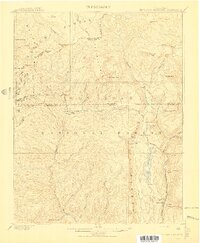
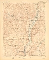
Other maps of this area

1898 · Durango
USGS Topo · 1:62,500

1898 · Engineer Mountain
USGS Topo · 1:62,500

1900 · Engineer Mountain
USGS Topo · 1:62,500

1900 · Needle Mountains
USGS Topo · 1:62,500

1902 · Needle Mountains
USGS Topo · 1:62,500
1907 · Durango
USGS Topo · 1:62,500
1908 · Engineer Mountain
USGS Topo · 1:62,500

1908 · Ignacio
USGS Topo · 1:125,000
1908 · Durango
USGS Topo · 1:62,500

1924 · Ignacio
USGS Topo · 1:125,000