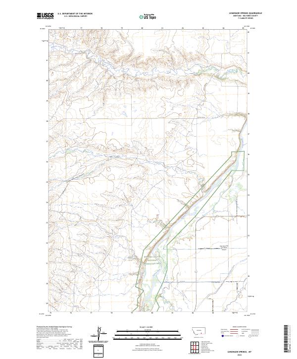
2024 Map of Lemonade Springs
USGS Topo · Published 2024About this map
Lemonade Springs sits in a high-plains landscape defined by the deep incision of the Bighorn River. This 2024 map documents the protected lands of the Bighorn Canyon National Recreation Area as they border the expansive drainage systems of Beauvais Creek and Hay Coulee. The presence of the Big Horn Canal and the Pale Morning Dun Ranch Airport on the eastern bank of the river suggests a landscape managed for both irrigation and specialized rural enterprise. These modern infrastructure points contrast with the ancient geological erosion shown in the South Fork Hay Coulee, providing a clear view of how water management and conservation boundaries intersect in this part of Big Horn County. Local transport is represented by long-standing routes such as the Pryor Cutoff and Spring Creek Rd, which navigate the high ridges above the river valley.
Find a feature on this map
19 named features on this map. Tap any name to fly to it.
Don’t see what you’re looking for? This feature index may not catch every label — zoom into the map to look around manually.
Map Details
Editions of this 2024 Lemonade Springs Map
This is the sole edition of this map. No revisions or reprints were ever made.
Other maps of this area

1894 · St. Xavier
USGS Topo · 1:125,000

1894 · Fort Custer
USGS Topo · 1:125,000

1901 · St. Xavier
USGS Topo · 1:125,000

1915 · Spenceville
USGS Topo · 1:31,680

1954 · Hardin
USGS Topo · 1:250,000

1957 · Hardin
USGS Topo · 1:250,000

1958 · Hardin
USGS Topo · 1:250,000

1960 · St Xavier
USGS Topo · 1:24,000

1960 · Mission Coulee
USGS Topo · 1:24,000

1960 · Hardin SW
USGS Topo · 1:24,000