
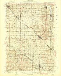
1943 Map of Lena
USGS Topo · Published 1943About this map
Blackhawk Battlefield And Monument serves as a central landmark in this 1943 survey of Northwestern Illinois, marking a landscape defined by its agricultural heritage and early transportation corridors. The topography is shaped by the drainage of Yellow Creek and the Apple River, while the Illinois Central and Chicago Great Western railroads dictate the placement of local hubs like Lena, Warren, and Stockton.
Find a feature on this map
96 named features on this map. Tap any name to fly to it.
Don’t see what you’re looking for? This feature index may not catch every label — zoom into the map to look around manually.
Map Details
Editions of this 1943 Lena Map
2 editions found
Other maps of this area

1892 · Savanna
USGS Topo · 1:62,500

1902 · Mineral Point
USGS Topo · 1:125,000

1911 · Elizabeth
USGS Topo · 1:62,500

1920 · Monroe
USGS Topo · 1:62,500

1922 · Monroe
USGS Topo · 1:62,500

1923 · South Wayne
USGS Topo · 1:62,500

1936 · Elizabeth
USGS Topo · 1:62,500

1937 · Lena
USGS Topo · 1:48,000

1939 · Freeport
USGS Topo · 1:48,000

1942 · Mt Carroll
USGS Topo · 1:62,500