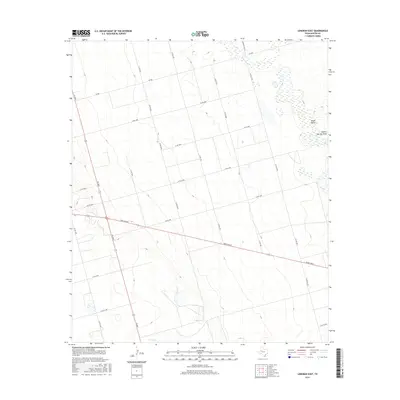
2016 Map of Lenorah East
USGS Topo · Published 2016About this map
Sulphur Springs Draw cuts through the northeastern landscape of this Martin County territory, defining a drainage pattern in an area characterized by scattered depressions and intermittent water features. This region of the Permian Basin reveals a meticulously surveyed grid of local transit, where secondary routes like Fm 2002 and Ranch Rd 87 intersect the vast ranchlands. The topography is subtle, with the basin-like Death Valley and the course of Calf Cr providing the primary relief against a network of county roads. These thoroughfares, including Farm Rd 3033 and numerous numbered county lines, suggest a landscape dominated by agricultural divisions and utility access typical of the Texas South Plains. The map captures the quiet infrastructure of rural West Texas, from the intersection at Fm 846 to the low-lying wetlands that appear after seasonal rains.
Find a feature on this map
27 named features on this map. Tap any name to fly to it.
Don’t see what you’re looking for? This feature index may not catch every label — zoom into the map to look around manually.
Map Details
Editions of this 2016 Lenorah East Map
This is the sole edition of this map. No revisions or reprints were ever made.
Other maps of this area

1941 · Morita
USGS Topo · 1:62,500

1949 · Morita
USGS Topo · 1:62,500

1954 · Big Spring
USGS Topo · 1:250,000

1958 · Big Spring
USGS Topo · 1:250,000

1966 · Knott
USGS Topo · 1:24,000

1966 · Merrick
USGS Topo · 1:24,000

1966 · Lenorah West
USGS Topo · 1:24,000

1966 · Flower Grove
USGS Topo · 1:24,000

1966 · Natural Dam Lake
USGS Topo · 1:24,000

1966 · Stanton
USGS Topo · 1:24,000