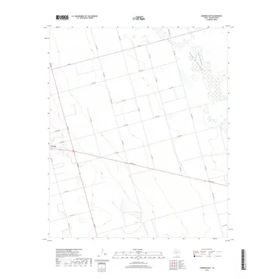
2019 Map of Lenorah East
USGS Topo · Published 2019About this map
Lenorah serves as the primary hub for this section of the High Plains, situated at the junction of FM 2002 and Ranch Rd 87. The landscape is defined by an extensive grid of county roads that cut across the Permian Basin, reflecting a highly organized agricultural and industrial land division. Natural drainage patterns interrupt the geometry, most notably the wide, marshy expanse of Sulphur Springs Draw which flows through the ironically named Death Valley in the northeast. In the south, the terrain slopes toward the seasonal headwaters of Calf Cr. This 2019 survey documents the modern infrastructure of Martin County, where long-established ranch roads like FM 846 and newer thoroughfares such as Farm Rd 3033 facilitate movement across this expansive West Texas territory.
Find a feature on this map
26 named features on this map. Tap any name to fly to it.
Don’t see what you’re looking for? This feature index may not catch every label — zoom into the map to look around manually.
Map Details
Editions of this 2019 Lenorah East Map
This is the sole edition of this map. No revisions or reprints were ever made.
Other maps of this area

1941 · Morita
USGS Topo · 1:62,500

1949 · Morita
USGS Topo · 1:62,500

1954 · Big Spring
USGS Topo · 1:250,000

1958 · Big Spring
USGS Topo · 1:250,000

1966 · Knott
USGS Topo · 1:24,000

1966 · Merrick
USGS Topo · 1:24,000

1966 · Lenorah West
USGS Topo · 1:24,000

1966 · Flower Grove
USGS Topo · 1:24,000

1966 · Natural Dam Lake
USGS Topo · 1:24,000

1966 · Stanton
USGS Topo · 1:24,000