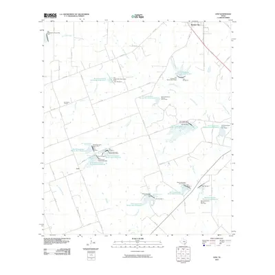
2010 Map of Lenz
USGS Topo · Published 2010About this map
Karnes City sits at the northern edge of this South Texas landscape, where the prairie begins to break into a sophisticated network of water management and flood control. The terrain is defined by the headwaters and tributaries of several prominent waterways, including Escondido Creek, Olmos Creek, and Bucker Creek. A striking feature of this 2010 survey is the extensive Soil Conservation Service infrastructure, with numbered dams and reservoirs like Soil Conservation Service Site 12 Reservoir and Soil Conservation Service Site 4 Reservoir distributed across the drainage basins of Doe Branch and Panther Creek. The settlement of Lenz anchors the southwestern quadrant, while the New Bremen Cemetery provides a point of genealogical interest for those tracing family ties to the rural communities northwest of the county seat. The map reveals how local agriculture and ranching have adapted to the watershed through a dense web of county roads and specific conservation engineering.
Find a feature on this map
61 named features on this map. Tap any name to fly to it.
Don’t see what you’re looking for? This feature index may not catch every label — zoom into the map to look around manually.
Map Details
Editions of this 2010 Lenz Map
This is the sole edition of this map. No revisions or reprints were ever made.
Other maps of this area

1925 · Tordia No. 1
USGS Topo · 1:48,000

1931 · Falls City
USGS Topo · 1:62,500

1936 · Pettus
USGS Topo · 1:62,500

1953 · Crystal City
USGS Topo · 1:250,000

1953 · Beeville
USGS Topo · 1:250,000

1955 · Crystal City
USGS Topo · 1:250,000

1956 · Suniland
USGS Topo · 1:62,500

1956 · Beeville
USGS Topo · 1:250,000

1956 · Pettus
USGS Topo · 1:62,500

1956 · Karnes City
USGS Topo · 1:62,500