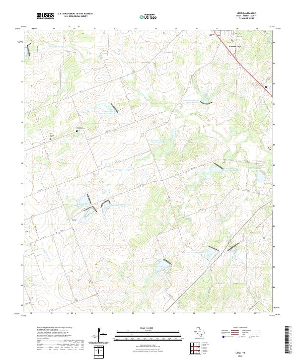
2022 Map of Lenz
USGS Topo · Published 2022About this map
Karnes City anchors the northeastern corner of this South Texas landscape, where the town's grid meets the rural road network of Karnes County. The terrain is defined by a sophisticated water management system, characterized by a series of engineered catchments including Soil Conservation Service Site 8 Reservoir and Soil Conservation Service Site 12 Reservoir. These sites sit alongside natural drainages like Escondido Cr and Bucker Cr, illustrating the region's historical efforts to control runoff and support agriculture in a semi-arid environment.
Find a feature on this map
55 named features on this map. Tap any name to fly to it.
Don’t see what you’re looking for? This feature index may not catch every label — zoom into the map to look around manually.
Map Details
Editions of this 2022 Lenz Map
This is the sole edition of this map. No revisions or reprints were ever made.
Other maps of this area

1925 · Tordia No. 1
USGS Topo · 1:48,000

1931 · Falls City
USGS Topo · 1:62,500

1936 · Pettus
USGS Topo · 1:62,500

1953 · Crystal City
USGS Topo · 1:250,000

1953 · Beeville
USGS Topo · 1:250,000

1955 · Crystal City
USGS Topo · 1:250,000

1956 · Suniland
USGS Topo · 1:62,500

1956 · Beeville
USGS Topo · 1:250,000

1956 · Pettus
USGS Topo · 1:62,500

1956 · Karnes City
USGS Topo · 1:62,500