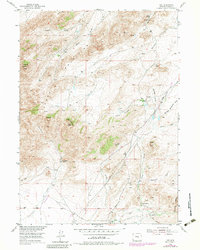
1953 Map of Leo
USGS Topo · Published 1983About this map
Pedro Mountains topography dominates this mid-century survey of Carbon County, where high-desert ranching life is anchored by family-named holdings. The settlement of Combs Ranch (Leo) serves as a primary reference point in a landscape defined by seasonal drainages and sharp peaks like Pyramid Peak and Heaths Peak. Land use in this era is evidenced by a network of water management features, including a Ditch and Flume system near Sage Creek, alongside an isolated Landing Strip that speaks to the distances required for regional travel. The drainage patterns of Indian Springs Creek and Gooseberry Creek carve through the high terrain, connecting the various ranching outposts such as Indian Grove Ranch, Irene Ranch, and Peters Ranch. The inclusion of landmarks like The Chimneys and Dome Rock provides essential orientation for navigating this cattle-and-sheep country before modern developments altered the rural road network.
Find a feature on this map
32 named features on this map. Tap any name to fly to it.
Don’t see what you’re looking for? This feature index may not catch every label — zoom into the map to look around manually.
Map Details
Editions of this 1953 Leo Map
3 editions found
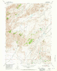
Other maps of this area

1951 · Pathfinder Reservoir NW
USGS Topo · 1:24,000

1951 · Bear Spring
USGS Topo · 1:24,000

1951 · Pathfinder Dam
USGS Topo · 1:24,000

1953 · Leo
USGS Topo · 1:24,000

1953 · Seminoe Dam NE
USGS Topo · 1:24,000

1953 · Seminoe Dam
USGS Topo · 1:24,000

1953 · Pathfinder Reservoir SW
USGS Topo · 1:24,000

1953 · Fourmile Ridge
USGS Topo · 1:24,000

1953 · Beaver Creek
USGS Topo · 1:24,000

1955 · Casper
USGS Topo · 1:250,000