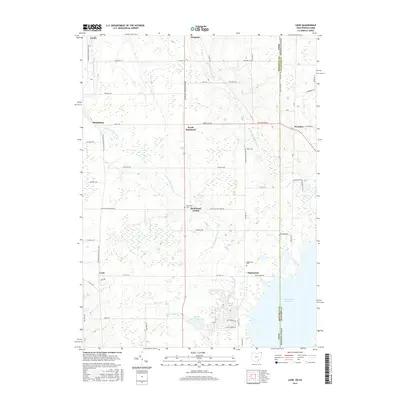
2016 Map of Leon
USGS Topo · Published 2016About this map
The Ashtabula Co Ohio Crawford Co Pennsylvania border runs vertically through this landscape, dividing the agricultural lands and river valleys of the two states. The rural character of the region is anchored by scattered settlements such as North Richmond, Pennline, and Leon, while the hydrology is dominated by the winding paths of the W Br Ashtabula River and E Br Ashtabula River. In the southeast, the shoreline of the Pymatuning Reservoir provides a significant water feature, complemented by the developed recreational area at Holiday Camplands Lake.
Find a feature on this map
61 named features on this map. Tap any name to fly to it.
Don’t see what you’re looking for? This feature index may not catch every label — zoom into the map to look around manually.
Map Details
Editions of this 2016 Leon Map
This is the sole edition of this map. No revisions or reprints were ever made.
Other maps of this area

1900 · Girard
USGS Topo · 1:62,500

1905 · Andover
USGS Topo · 1:48,000

1906 · Conneaut
USGS Topo · 1:62,500

1906 · Linesville
USGS Topo · 1:62,500

1907 · Andover
USGS Topo · 1:62,500

1908 · Linesville
USGS Topo · 1:62,500

1950 · Cleveland
USGS Topo · 1:250,000

1956 · Cleveland
USGS Topo · 1:250,000

1959 · Hartstown
USGS Topo · 1:24,000

1959 · Beaver Center
USGS Topo · 1:24,000