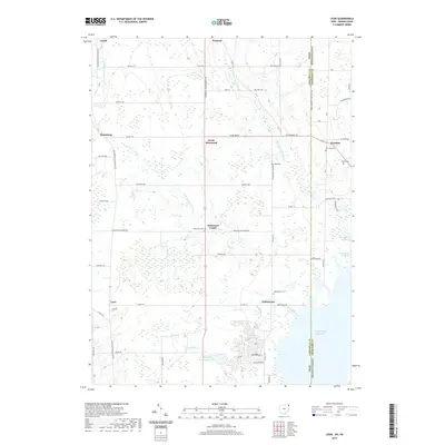
2019 Map of Leon
USGS Topo · Published 2019About this map
The Ohio-Pennsylvania state line bisects this 2019 survey, where Ashtabula County meets Crawford County. The eastern margin is defined by the reaching waters of Pymatuning Reservoir, a dominant hydrological feature that shapes the local geography. Small, historically established crossroads like Pennline and Richmond Center anchor the rural landscape, which is drained by the winding courses of the W Br Ashtabula River and the E Br Ashtabula River.
Find a feature on this map
57 named features on this map. Tap any name to fly to it.
Don’t see what you’re looking for? This feature index may not catch every label — zoom into the map to look around manually.
Map Details
Editions of this 2019 Leon Map
This is the sole edition of this map. No revisions or reprints were ever made.
Other maps of this area

1900 · Girard
USGS Topo · 1:62,500

1905 · Andover
USGS Topo · 1:48,000

1906 · Conneaut
USGS Topo · 1:62,500

1906 · Linesville
USGS Topo · 1:62,500

1907 · Andover
USGS Topo · 1:62,500

1908 · Linesville
USGS Topo · 1:62,500

1950 · Cleveland
USGS Topo · 1:250,000

1956 · Cleveland
USGS Topo · 1:250,000

1959 · Hartstown
USGS Topo · 1:24,000

1959 · Beaver Center
USGS Topo · 1:24,000