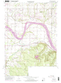
1957 Map of Leonard
USGS Topo · Published 1975About this map
Arkansas River floods and the fertile Kadashan Bottom dominate this landscape southeast of Tulsa, where the Tulsa, Wagoner, and Okmulgee County lines converge. The settlement of Leonard sits at the foot of the Stone Bluff uplands, positioned along the Texas and Pacific rail line and the base of the Conjada Mountains. In this mid-century period, the area's economy is clearly defined by an extensive Oil and Gas Field and extractive industries, including a Strip Mine and Gravel Pit. Local community life is anchored by rural institutions like White Ch, the Church of God, and Leonard Sch. The complex river morphology is managed by an extensive Levee system, protecting the agricultural flats and infrastructure like the Broken Arrow Waterworks from the shifting channels of the river.
Find a feature on this map
30 named features on this map. Tap any name to fly to it.
Don’t see what you’re looking for? This feature index may not catch every label — zoom into the map to look around manually.
Map Details
Editions of this 1957 Leonard Map
4 editions found
Other maps of this area

1896 · Okmulgee
USGS Topo · 1:125,000

1900 · Okmulgee
USGS Topo · 1:125,000

1901 · Claremore
USGS Topo · 1:125,000

1914 · Claremore
USGS Topo · 1:125,000

1916 · Claremore
USGS Topo · 1:125,000

1946 · Fort Smith
USGS Topo · 1:250,000

1952 · Jenks
USGS Topo · 1:24,000

1954 · Tulsa
USGS Topo · 1:250,000

1955 · Broken Arrow
USGS Topo · 1:24,000

1957 · Leonard
USGS Topo · 1:24,000