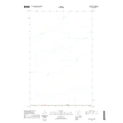
2020 Map of Leroy OE N
USGS Topo · Published 2020About this map
The international border with Canada defines the southern reach of this survey, where the land reflects a strictly regulated agricultural grid system. The hydrology of the region is dominated by engineered water management, characterized by the Rosenheim Drain and Buffalo Drain. These systems, along with the natural course of Buffalo Cr, suggest a landscape historically shaped by the need for drainage to support prairie farming. Situated within t164n-r56w, the map shows a sparse road network and minimal residential development, preserving a clear view of the rural township and range divisions that have organized the borderlands for generations.
Find a feature on this map
5 named features on this map. Tap any name to fly to it.
Don’t see what you’re looking for? This feature index may not catch every label — zoom into the map to look around manually.
Map Details
Editions of this 2020 Leroy OE N Map
This is the sole edition of this map. No revisions or reprints were ever made.
Other maps of this area

1918 · Walhalla
USGS Topo · 1:62,500

1939 · Cavalier
USGS Topo · 1:62,500

1941 · Cavalier
USGS Topo · 1:62,500

1943 · Walhalla
USGS Topo · 1:62,500

1952 · Thief River Falls
USGS Topo · 1:250,000

1956 · Thief River Falls
USGS Topo · 1:250,000

1957 · Thief River Falls
USGS Topo · 1:250,000

1964 · Leroy
USGS Topo · 1:24,000

1964 · Walhalla
USGS Topo · 1:24,000
1964 · Cavalier NW
USGS Topo · 1:24,000