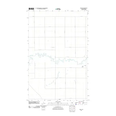
2011 Map of Leroy
USGS Topo · Published 2011About this map
The Pembina River meanders sharply across this northeastern North Dakota landscape, its serpentine path defining the central portion of the survey. The settlement of Leroy sits just south of the river bends, accompanied by the Saint Joseph Cemetery, providing a focal point for local genealogical research in this rural pocket of Pembina County. The terrain is structured by a rigid grid of agricultural roads, including 108th St NE and 132nd Ave NE, which connect isolated farmsteads like Artic Farm at the northern edge. Near the southern border, the community of Leyden marks a junction along County Rd 1. This map illustrates a modern agricultural economy where transport is dominated by county routes like County Rd 9 and County Rd 12, which replaced earlier pioneer trails while maintaining the original township and range land divisions.
Find a feature on this map
21 named features on this map. Tap any name to fly to it.
Don’t see what you’re looking for? This feature index may not catch every label — zoom into the map to look around manually.
Map Details
Editions of this 2011 Leroy Map
This is the sole edition of this map. No revisions or reprints were ever made.
Other maps of this area

1918 · Walhalla
USGS Topo · 1:62,500

1939 · Cavalier
USGS Topo · 1:62,500

1941 · Cavalier
USGS Topo · 1:62,500

1943 · Walhalla
USGS Topo · 1:62,500

1952 · Thief River Falls
USGS Topo · 1:250,000

1956 · Thief River Falls
USGS Topo · 1:250,000

1957 · Thief River Falls
USGS Topo · 1:250,000

1964 · Hallson
USGS Topo · 1:24,000

1964 · Leroy
USGS Topo · 1:24,000

1964 · Walhalla
USGS Topo · 1:24,000