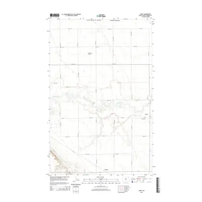
2014 Map of Leroy
USGS Topo · Published 2014About this map
The Pembina River carves a winding path through the center of this Pembina County landscape, creating a distinct riparian corridor amidst the agricultural grid of northeast North Dakota. The settlement of Leroy serves as a local focal point, situated near the Saint Joseph Cem just north of Co Road 9. Further south, the community of Leyden marks a junction along Co 1, where the flat prairie begins to meet more varied elevation changes near Bush Rd.
Find a feature on this map
25 named features on this map. Tap any name to fly to it.
Don’t see what you’re looking for? This feature index may not catch every label — zoom into the map to look around manually.
Map Details
Editions of this 2014 Leroy Map
This is the sole edition of this map. No revisions or reprints were ever made.
Other maps of this area

1918 · Walhalla
USGS Topo · 1:62,500

1939 · Cavalier
USGS Topo · 1:62,500

1941 · Cavalier
USGS Topo · 1:62,500

1943 · Walhalla
USGS Topo · 1:62,500

1952 · Thief River Falls
USGS Topo · 1:250,000

1956 · Thief River Falls
USGS Topo · 1:250,000

1957 · Thief River Falls
USGS Topo · 1:250,000

1964 · Hallson
USGS Topo · 1:24,000

1964 · Leroy
USGS Topo · 1:24,000

1964 · Walhalla
USGS Topo · 1:24,000