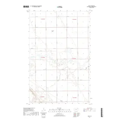
2017 Map of Leroy
USGS Topo · Published 2017About this map
The Pembina River winds through the heart of this northeastern North Dakota landscape, carving a deep, wooded valley through the otherwise level agricultural plains of Pembina County. The small community of Leroy serves as a primary local landmark, situated just east of the river's bend and adjacent to the Saint Joseph Cem. The map reveals a highly structured township-and-range grid, where section lines are defined by long, straight thoroughfares like 109th St NE and Co Rd 55.
Find a feature on this map
23 named features on this map. Tap any name to fly to it.
Don’t see what you’re looking for? This feature index may not catch every label — zoom into the map to look around manually.
Map Details
Editions of this 2017 Leroy Map
This is the sole edition of this map. No revisions or reprints were ever made.
Other maps of this area

1918 · Walhalla
USGS Topo · 1:62,500

1939 · Cavalier
USGS Topo · 1:62,500

1941 · Cavalier
USGS Topo · 1:62,500

1943 · Walhalla
USGS Topo · 1:62,500

1952 · Thief River Falls
USGS Topo · 1:250,000

1956 · Thief River Falls
USGS Topo · 1:250,000

1957 · Thief River Falls
USGS Topo · 1:250,000

1964 · Hallson
USGS Topo · 1:24,000

1964 · Leroy
USGS Topo · 1:24,000

1964 · Walhalla
USGS Topo · 1:24,000